Quarterly Climate Impacts and Outlook for the Mid-Atlantic Region for March - May 2021. Dated June 2021.
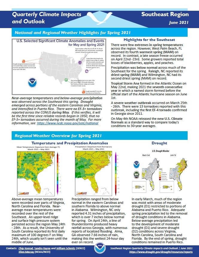
Quarterly Climate Impacts and Outlook for the Southeast Region for March - May 2021. Dated June 2021.
Above-average mean temperatures were recorded over parts of Virginia, North Carolina and Florida. Near-average mean temperatures were recorded over the rest of the Southeast. Precipitation ranged from below normal in the eastern Carolinas and southern Florida to above normal in Alabama.
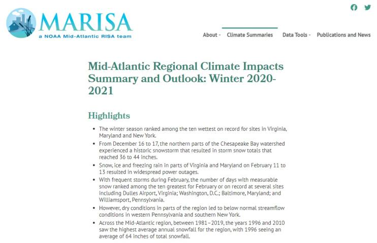
Quarterly Climate Impacts and Outlook for the Chesapeake Bay Region for December 2020 – February 2021. Dated March 2021.
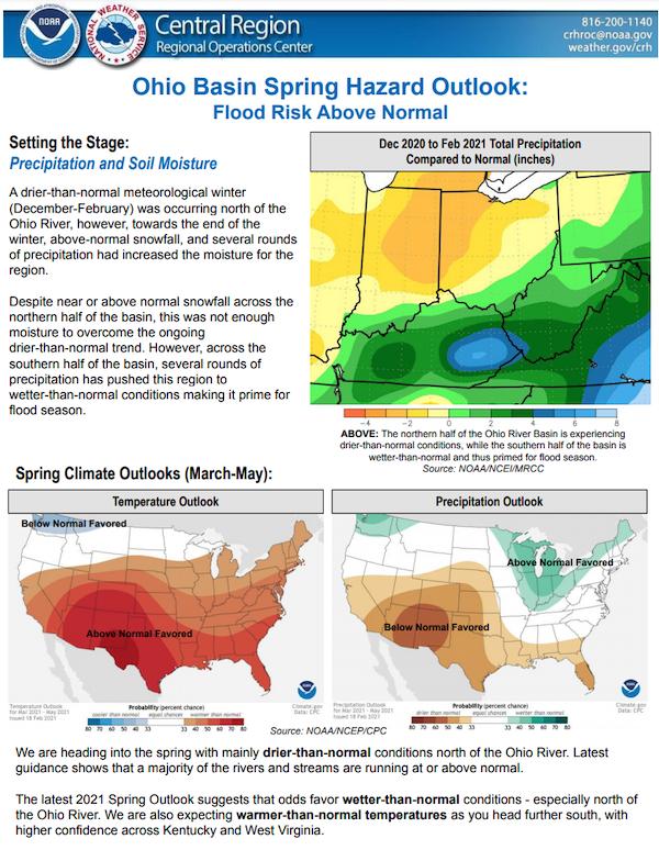
The National Weather Service developed 2021 Spring Hazard Outlooks in coordination with the National Centers for Environmental Information, National Integrated Drought Information System (NIDIS), U.S. Department of Agriculture, National Weather Service River Forecast Centers, and National Interagency Fire Centers' Geographic Area Coordination Centers. This outlook highlights the various Spring hazards that could occur and potential impacts across the Ohio River Valley.


