U.S. flag

An official website of the United States government

The U.S. government is closed. This site will not be updated; however, NOAA websites and social media channels necessary to protect lives and property will be maintained. To learn more, visit commerce.gov.

For the latest forecasts and critical weather information, visit weather.gov.
Document Preview
Document Date
September 17, 2020
Document Description

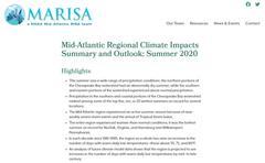
Quarterly Climate Impacts and Outlook for the Chesapeake Bay Region for June – August 2020. Dated September 2020.

The entire region experienced warmer-than-normal conditions; it was the hottest summer on record for Norfolk, Virginia, and Harrisburg and Williamsport, Pennsylvania.  This summer saw a wide range of precipitation conditions; the northern portions of the Chesapeake Bay watershed had an abnormally dry summer, while the southern and eastern portions of the watershed experienced above normal precipitation.

Document Preview
Document Date
September 17, 2020
Document Description

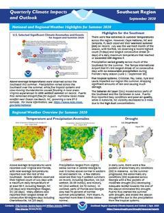
Quarterly Climate Impacts and Outlook for the Southeast Region for June – August 2020.  Dated September 2020.

Above-average temperatures were recorded over Virginia and Florida, with near-average temperatures reported over the rest of the Southeast. A few stations observed their top 5 wettest summers on record, including Staunton, VA and Hickory, NC. In contrast, parts of Florida and Georgia only had 70 percent of normal summer precipitation.

Document Preview
Document Date
March 23, 2020
Document Description

Quarterly Climate Impacts and Outlook for the Chesapeake Bay Region for December 2019 – February 2020. Dated March 2020.

The entire region experienced an unusually mild winter, which ranked among the ten warmest on record for many sites.  Precipitation departures from normal show that the Chesapeake Bay watershed experienced both more and less precipitation than historical averages. 

Document Preview
Document Date
March 20, 2020
Document Description

Quarterly Climate Impacts and Outlook for the Southeast Region for December 2019 – February 2020.  Dated March 2020.

Above-average temperatures were recorded over most of the Southeast. Maximum temperatures were generally near normal, but minimum temperatures were 3-6 F above normal due to high humidity and cloud cover.  Precipitation ranged from slightly below normal in the Florida peninsula to over 10 inches above normal in northern Alabama.

Document Preview
Document Date
December 22, 2019
Document Description

Quarterly Climate Impacts and Outlook for the Chesapeake Bay Region for September – November 2019. Dated December 2019.

Document Preview
Document Date
December 22, 2019
Document Description

Quarterly Climate Impacts and Outlook for the Southeast Region for September – November 2019.  Dated December 2019.

Above-average temperatures were recorded over most of the Southeast. Mean temperatures were in the top five warmest at 35 long-term stations.  Autumn precipitation was below normal for most of the Southeast region. None of the long-term stations ranked within the top 10 wettest for the season.

Document Preview
Document Date
September 20, 2019
Document Description

Quarterly Climate Impacts and Outlook for the Chesapeake Bay Region for June – August 2019. Dated September 2019.

Temperature was above normal for much of the region throughout the summer months, and July ranked as one of the ten all-time warmest months on record for several locations.  High intensity rainfall events occurred throughout the Chesapeake Bay watershed, resulting in two rare National Weather Service Flash Flood Emergencies.

Document Preview
Document Date
September 20, 2019
Document Description

Quarterly Climate Impacts and Outlook for the Southeast Region for June – August 2019.  Dated September 2019.

Above-average temperatures were recorded over most of the Southeast.  Summer precipitation was highly variable across the Southeast, as departures ranged from less than 75% to more than 200% of normal.

Document Preview
Document Date
June 20, 2019
Document Description

Quarterly Climate Impacts and Outlook for the Chesapeake Bay Region for March – May 2019. Dated June 2019.

Spring temperature was above average for most of the Chesapeake Bay watershed. Spring precipitation was up to double historical averages in the northern Chesapeake Bay.

Document Preview
Document Date
June 20, 2019
Document Description

Quarterly Climate Impacts and Outlook for the Southeast Region for March – May 2019.  Dated June 2019.

Above-average temperatures were recorded over most of the Southeast. Mean temperatures were 2-4 F above normal for most of the region.  Spring precipitation was around 50% to 90% of normal across much of the Southeast, except in western NC, and parts of central NC and AL, where it went up to 130% of normal.

Subscribe to Virginia