Some maps and data on Drought.gov may be temporarily delayed. We are working to resolve the issue and apologize for the inconvenience.
Site Section
Data & Maps
Visual Drought Atlas
Associated Agencies
National Drought Mitigation Center (NDMC)
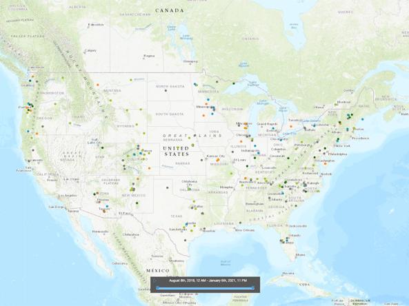
The Visual Drought Atlas is a way to compare the appearance of different landscapes over time, in dry, wet and normal years.
This effort, now housed at the National Drought Mitigation Center (NDMC), includes the archives of photos collected by CoCoRaHS and SCIPP through Field Days. The transition was supported by the U.S. Department of Agriculture.
How to
- Navigate to the Visual Drought Atlas home page
- Select the desired resource:
- Visual Drought Atlas Interactive Map
- Use slider to set time period.
- Select a tab to view images by U.S. Drought Monitor status, land use, or dryness/wetness.
- Click on points to view information and images.
- Submit Photos
- Visual Drought Atlas Interactive Map
Access
Partner(s)
Representative Image