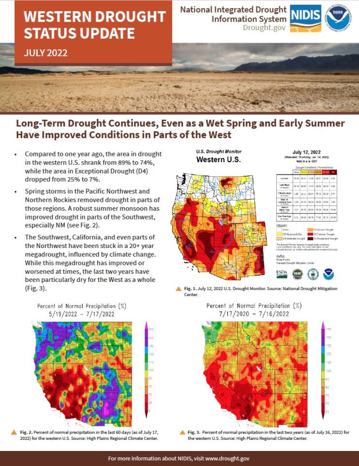
Compared to one year ago, the area in drought in the western U.S. shrank from 89% to 73%, while the area in Exceptional Drought (D4) dropped from 25% to 7%. Spring storms in the Pacific Northwest and Northern Rockies removed drought in parts of those regions. A robust summer monsoon has improved drought in parts of the Southwest, especially western New Mexico. The Southwest, California, and even parts of the Northwest have been stuck in a 20+ year megadrought, influenced by climate change.
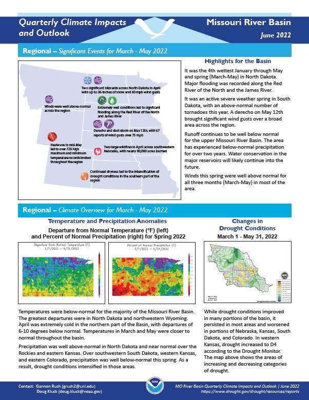
Quarterly Climate Impacts and Outlook for the Missouri River Basin for March–May 2022. Dated June 2022.
Temperatures were below normal for the majority of the Missouri River Basin. The greatest departures were in North Dakota and northwestern Wyoming. Precipitation was well above normal in North Dakota and near normal over the Rockies and eastern Kansas. Over southwestern South Dakota, western Kansas, and eastern Colorado, precipitation was well below normal this spring.
The National Integrated Drought Information System (NIDIS) is pleased to share our 2021 Annual Report to provide insight into the many accomplishments of the program over the previous year and the opportunities that lie ahead.
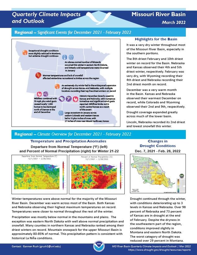
Quarterly Climate Impacts and Outlook for the Missouri River Basin for December 2021–February 2022. Dated March 2022.
Winter temperatures were above normal for the majority of the Missouri River Basin. Precipitation was mostly below normal in the mountains and plains. The exception was eastern North Dakota with well-above-normal precipitation and snowfall. Many counties in northern Kansas and Nebraska ranked among their driest winters on record.


