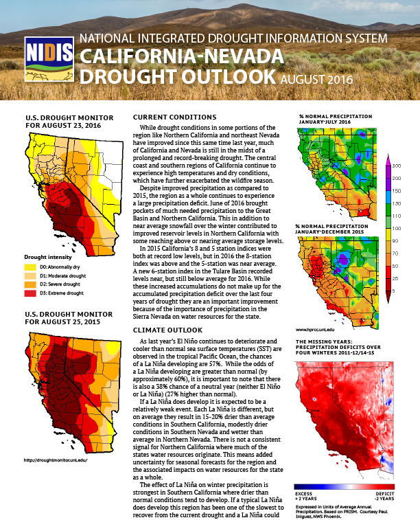
Document developed from California-Nevada Drought Early Warning System Drought & Climate Outlook Webinar on Aug. 24, 2016. Includes information on current conditions, the climate outlook, impacts, state actions in response to drought. Graphics include U.S. Drought Monitor compared year-over-year conditions; percent of normal precipitation Jan.-July 2016 and Jan.-Dec. 2015; precipitation deficits during winters of 2011-2015; more.
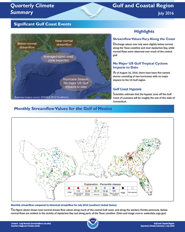
Quarterly Climate Impacts and Outlook for the Gulf and Coastal Region for June – July 2016. Dated July 2016.
On March 21, 2016, President Obama signed a Presidential Memorandum directing Federal agencies to build national capabilities for long-term drought resilience.

Review of conditions in July/Aug 2016; EDDI; water resources; short- and long-term outlooks for temps, precipitation and drought.
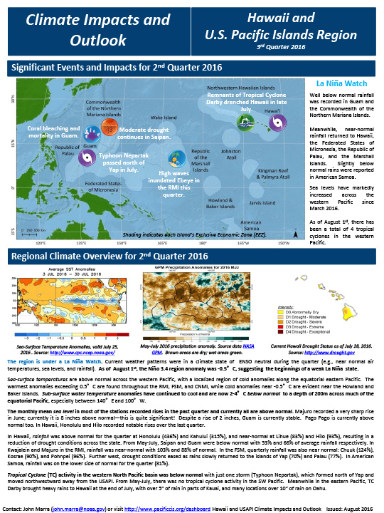
Quarterly Climate Impacts and Outlooks for the Pacific Region for May – July 2016. Dated August 2016.
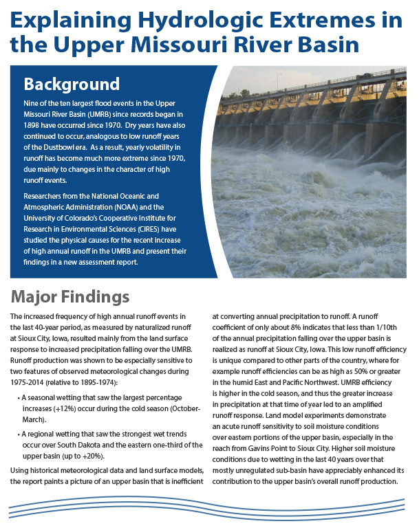
Two-page summary of the Climate Assessment Report: Causes for Hydrologic Extremes in the Upper Missouri River Basin. The report demonstrates a strong physical connection between the increased frequency of high annual runoff events in the UMRB and the increase in precipitation falling over the upper basin.
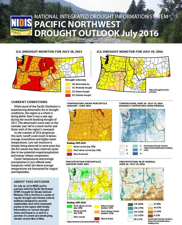
Summary of July 26, 2016 webinar: current conditions and impacts, outlook, information on La Niña.
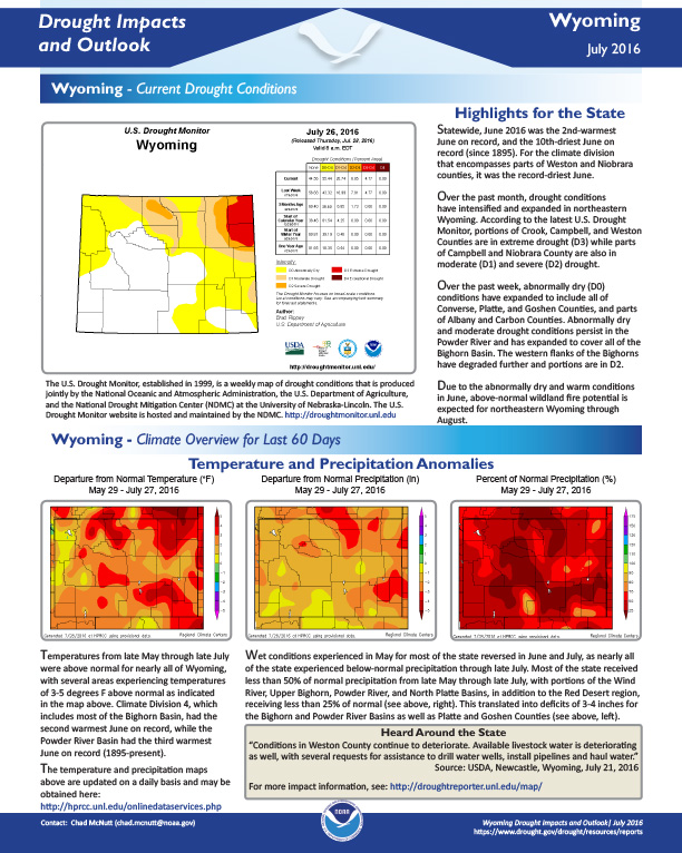
Drought conditions, temperature and precipitation anomalies, evaporative demand, weather/climate/wildfire outlooks for Wyoming at the end of July 2016.
Agenda of webinar, definition of NIDIS, definition of Drought Early Warning System, details about launch of Pacific Northwest Drought Early Warning System.
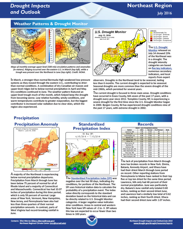
Drought Impacts and Outlook for the Northeast Region for March - June 2016. Dated July 2016.