While much of the Pacific Northwest is experiencing abnormally dry or drought conditions, the region as a whole is faring better than it was a year ago during the record-breaking drought of 2015. The abnormally warm start to the calendar year led to a much earlier and faster melt of the region’s snowpack. As the summer of 2016 progresses this early runoff could result in below-average streamflows and higher water temperatures.
Slides with maps show:
Despite some relief in early July when substantial precipitation fell in some basins, precipitation overall has been well below average through July along the Rocky Mountain Front and Upper Yellowstone for the second year in a row. Above-average temperatures coupled with diminished snowpack also led to early runoff. Low soil moisture levels depicted by NASA GRACE models illustrate the lack of June precipitation which impacted shallow groundwater and root zone moisture particularly along the Rocky Mountain Front and Upper and Lower Yellowstone.
As last year’s El Niño continues to deteriorate, CPC has issued a La Niña watch as conditions favorable to the development of an (albeit weak) La Niña are expected to continue during August-October. CPC is predicting a 55-60% chance of La Niña occurring during the fall and winter of 2016-17.
Previous La Nina’s have brought cooler and wetter conditions to the Pacific Northwest during winter months.
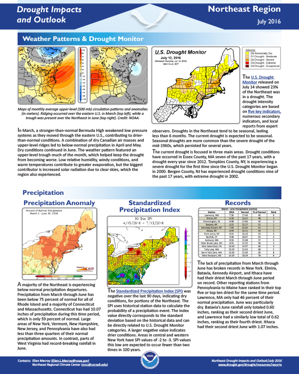
Outlook responds to worsening drought conditions in the Northeast, summer 2016, including information on weather patterns, precipitation, water resources, fire danger, drought advisories, agriculture, and what may be ahead.
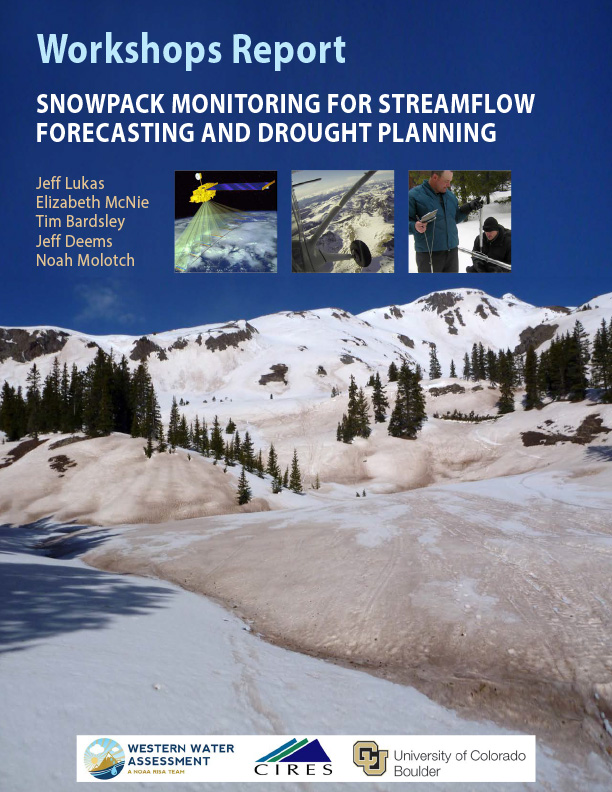
For water providers and others in the Rocky Mountain West who depend on the pulse of runoff from the melting snowpack from April through July, snowpack monitoring is drought monitoring. A well below average snowpack as measured by snow-water equivalent (SWE) is a harbinger of not only low water supply but also other drought impacts, such as increased fire risk and below-normal summer soil moisture.
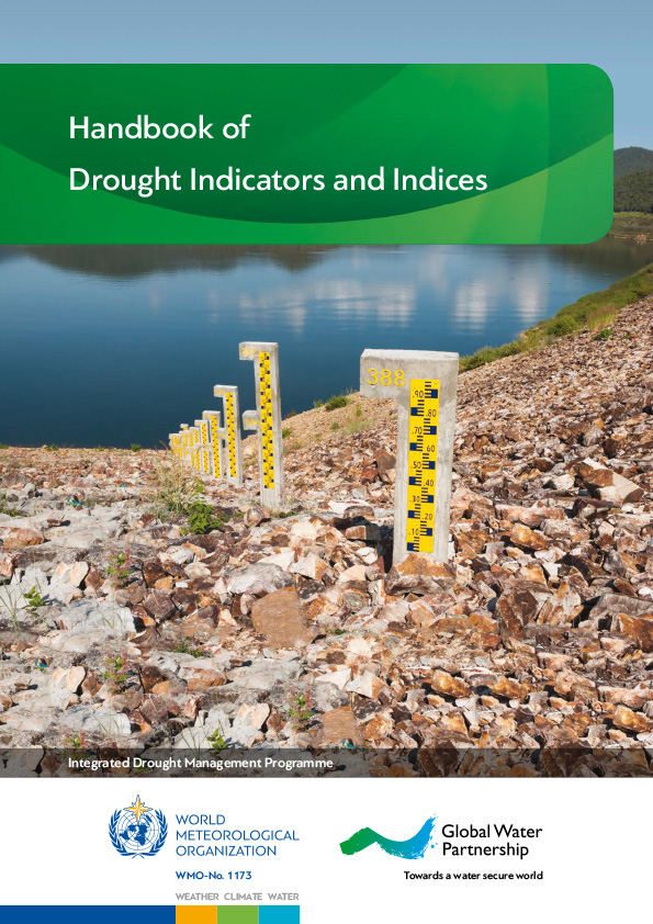
The purpose of this handbook is to cover some of the most commonly used drought indicators/indices that are being applied across drought-prone regions, with the goal of advancing monitoring, early warning and information delivery systems in support of risk-based drought management policies and preparedness plans.
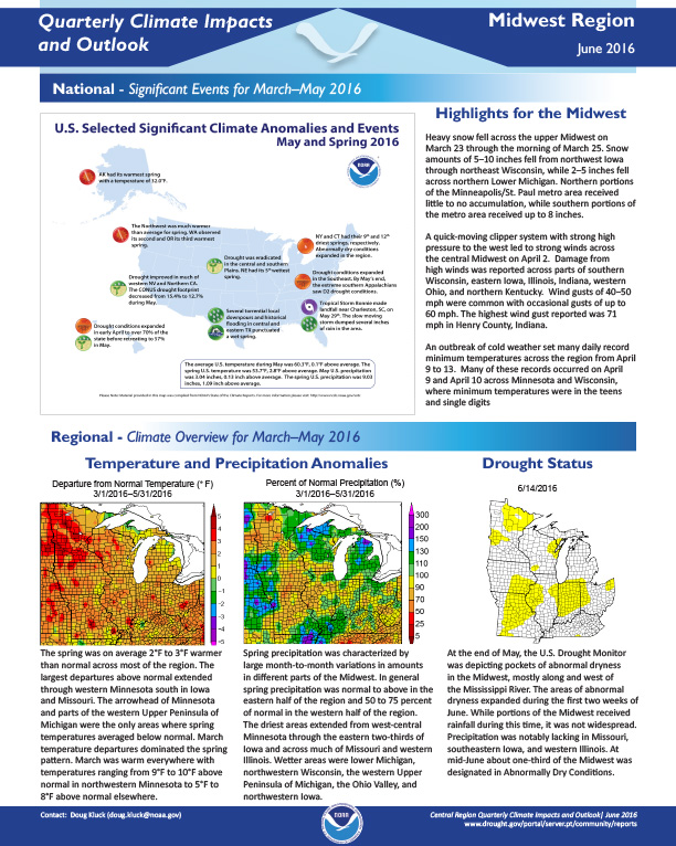
Quarterly Climate Impacts and Outlook for the Midwest Region for March – May 2016. Dated June 2016.
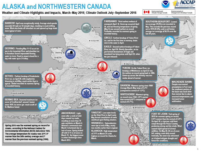
Quarterly Climate Impacts and Outlook for Alaska and Northwestern Canada for March – May 2016. Dated June 2016.
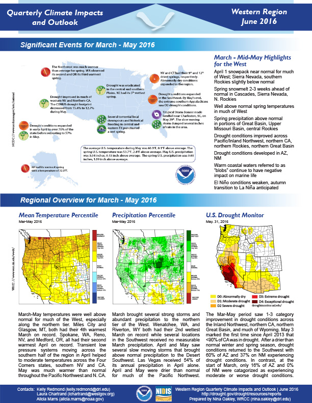
Quarterly Climate Impacts and Outlook for the Western Region March – May 2016. Dated June 2016.