Umatilla Drought Dashboard Provides Drought Early Warning to Protect Indigenous First Foods
The culturally relevant decision-support tool brings together technical data, community observations, and ecological priorities.
When drought develops, its effects extend well beyond a single number or a color on a map. Changes in precipitation, streamflow, groundwater and water supplies affect the plants, fish, wildlife, and people connected to the landscape. The Confederated Tribes of the Umatilla Indian Reservation (CTUIR) created its Drought Early Warning System (DEWS) Dashboard to bring those relationships into one accessible and culturally relevant information source.
NIDIS funded the project, “Developing a Drought Early Warning System and Indices for the Confederated Tribes of the Umatilla Indian Reservation” through the Fiscal Year 2022 Coping with Drought Building Tribal Drought Resilience competition and work concluded earlier this year. The web-based dashboard strengthens drought decision support and communication by connecting local and regional drought metrics with CTUIR’s First Foods monitoring and the conditions experienced by Tribal members on the land and with water.
“We need a holistic approach that incorporates ecosystems and people; something that honors the agency of each of the First Foods and recognizes how we interact with the landscape,” said Lyndsi Lewis, a technician with the CTUIR Water Resources Program. “The dashboard helps us see drought not as one isolated measurement, but through the relationships that sustain our community.”
Centering First Foods
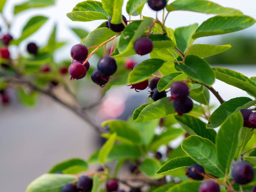
Since time immemorial, CTUIR people live in reciprocity with the First Foods- Čúuš (water), Núsux (salmon), Yáamaš (deer), Xáwš (cous, desert parsley), and Wíwnu (huckleberry). For members of CTUIR, it is important that they take care of these First Foods as they have cared for the people. That relationship shapes both the structure of the dashboard and the broader drought resilience effort. A dedicated First Foods Monitoring section highlights information about First Foods and their habitat, pairing descriptions of drought impacts with monitoring by CTUIR’s Department of Natural Resources and partner agencies.
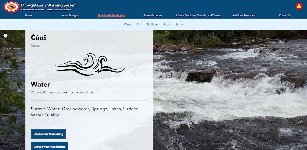
For example, the Čúuš (water) section includes streamflow, groundwater, springs, surface-water quality, water chemistry, and Lake Híyuumptípin monitoring data. The Dashboard brings this monitoring data together with Tribally-developed drought indices to define drought in groundwater levels, streamflow, and precipitation. Combined, this information provides a more complete picture of how drought is developing across the Umatilla Indian Reservation in northeastern Oregon, helping Tribal resource managers locate emerging Čúuš (water) concerns that may require attention.
Community Knowledge as Early Warning
Community participation is a defining feature of the dashboard. Hunters, fishers, and gatherers can use DEWS and share information on their activities and the near-real-time conditions they observe. This on-the-ground insight is particularly valuable, as these users often interact directly with First Foods monitored on the Dashboard. Individual responses are not displayed publicly, and personal or sensitive locations remain protected. Responses are summarized annually to help identify ecosystem changes relevant to climate and drought assessments.
The dashboard also provides current conditions, outlooks, and forecasts; visual information about drought status, water supply, and weather; and educational resources explaining drought at local, state, regional, and national scales. By combining technical monitoring with community knowledge and the First Foods framework, CTUIR has created a tool designed not only to describe drought, but to support timely, culturally grounded decisions as conditions change.
From Data to Long-Term Readiness
The dashboard is one part of a larger body of work completed through the project. CTUIR analyzed long-term groundwater-level, precipitation, and stream-discharge records to develop groundwater indices to classify and assess drought.
The Tribal Water Resources Program also expanded monitoring of basalt aquifers and headwater springs. To better understand this water, they drilled three basalt monitoring wells at different levels in the aquifer in a developing area of the Reservation. These wells will support long-term tracking of groundwater-level changes and drought impacts.
The project also kickstarted a water conservation plan for the Umatilla Indian Reservation community and the First Foods, including drought mitigation and adaptation strategies.
Together, the monitoring network, drought indices, conservation planning, community engagement, and dashboard create a clearer path from observing changing environmental conditions to communicating concerns and taking informed actions.
“What stands out most is how many pieces come together to inform policy makers and the community on the well-being of the First Foods and how we may mitigate drought with planning,” Lewis said. “We are building a shared way to recognize impacts of drought earlier and respond in ways that support both the community and the First Foods. It’s the strong relationship between the Tribal members, CTUIR programs, and our local, state, and federal partners that makes the protection of the First Foods possible.”