Document Preview

Document Date
May 15, 2014
Document Description
Presented at the California Drought Forum May 15-16, 2014 in Sacramento, CA.
Document Preview

Document Date
May 15, 2014
Document Description
Presented at the California Drought Forum May 15-16, 2014 in Sacramento, CA.
Document Preview

Document Date
May 15, 2014
Document Description
Presented at the California Drought Forum May 14-15, 2014 in Sacramento, CA.
Document Preview

Document Date
October 5, 2015
Document Description
Full Title: Causes of the 2013-2014 California Drought: An unfortunate series of weather, ocean-forced variability and/or climate change. Presented at the California Drought Forum May 15-16, 2014.
Document Preview

Document Date
May 15, 2014
Document Description
Presented at the California Drought Forum May 15-16, 2014.
Document Preview

Document Date
May 15, 2013
Document Description
CPC product overview presented at the California Drought Forum May 15-16, 2014.
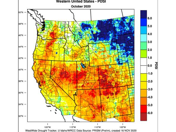
Document Preview

Document Date
May 15, 2014
Document Description
Update on statewide drought conditions as of the workshop date.
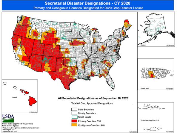
Document Preview

Document Date
May 15, 2014
Document Description
California State responses to the drought.