U.S. flag

An official website of the United States government

The Northeast Drought Early Warning System (DEWS) Dashboard, hosted by the Northeast Regional Climate Center, displays current drought status, impacts, and future conditions for the Northeast DEWS region.

Published on

NOAA’s National Integrated Drought Information System (NIDIS) has launched the redesigned U.S. Drought Portal (www.drought.gov) to better serve stakeholders, decision makers, the media, and the public. The new website features updated content and new interactive architecture designed to provide actionable, shareable information and easy-to-understand graphics describing current drought conditions and forecasts by city, county, state, zip code, and at watershed to global scales. The Drought Portal also aggregates and presents drought impact data for economic sectors such as agriculture, energy, water utilities, and tourism and recreation using interactive maps and data that don’t exist anywhere else

Event Date
June 3, 2020
2:00 pm - 3:00 pm
Location
Virtual

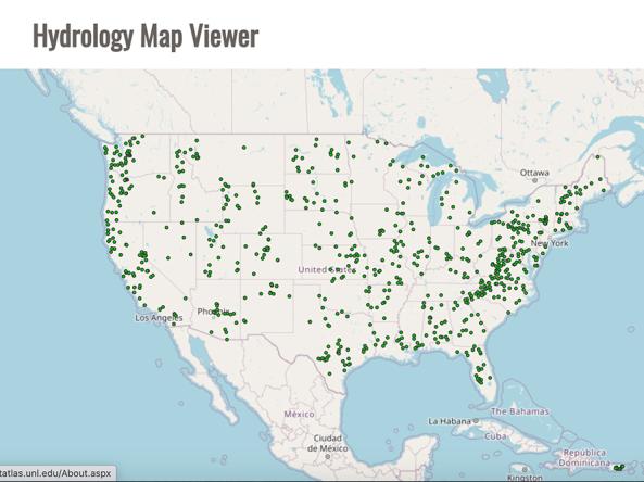
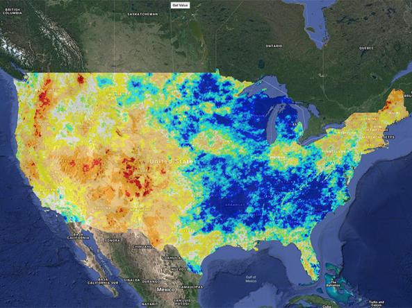
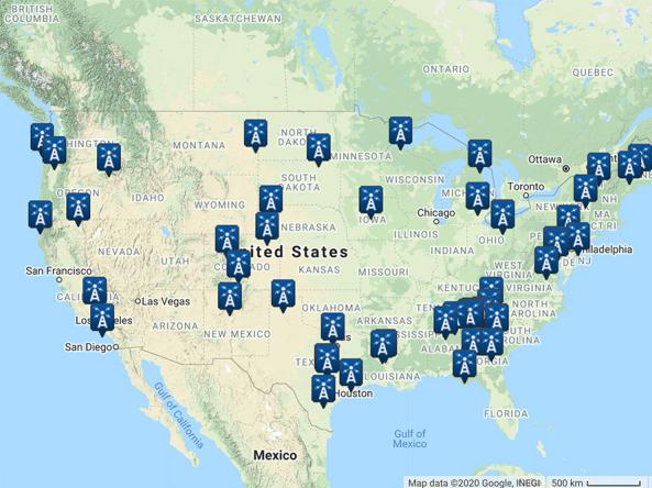
Learn about two toolkits that support drought monitoring and drought decision-making across the lower 48 states: the Integrated Water Portal and The Climate Toolbox. The Integrated Water Portal brings together water data from several different agencies into a map-driven data exploration and visualization tool that is designed to support drought monitoring at state and basin scales. This site allows users to quickly explore regional and local water conditions with a focus on surface and near surface supplies. The Climate Toolbox is a set of mapping/graphing tools that can be used to explore climate/hydrology data in real-time with comparisons to the past and insight into the future (sub-seasonal to seasonal forecasts and future projections) at gridded locations over the lower 48. The presentation will also feature users' perspectives, including how the State of Washington's Drought Coordinator uses The Climate Toolbox for state drought monitoring.

cli-MATE is the MRCC's Application Tools Environment for accessing climate data and value-added tools. cli-MATE can be used to look up such information as raw climate data, rankings of climate information, thresholds, growing season tools, maps, graphs, and more.

This tool, available as part of The Climate Toolbox, provides maps and summary tables of different drought types, such as agricultural and meteorological drought, for a location in the contiguous United States and enables easy comparison to a display of the current map of the U.S. Drought Monitor.

The CVTEMP tool is the public interface for modeled and observed water temperature and flow data for the Sacramento River associated with Shasta Reservoir, Shasta Dam operations, and meteorological conditions.

The Drought Risk Atlas provides historic data about drought through 2017 for weather stations across the United States that have at least 40 years of records.

Climate Engine allows users to analyze and interact with climate and earth observations for decision support related to drought, water use, agricultural, wildfire, and ecology.

NCEI Find a Station tool: a tool for retrieving weather records from observing stations by entering the desired location, data set, data range, and data category.

Subscribe to Tools