Logo
Site Section
Partner
Centers for Disease Control and Prevention (CDC)
An Agency/Organization of:
Related Data & Maps
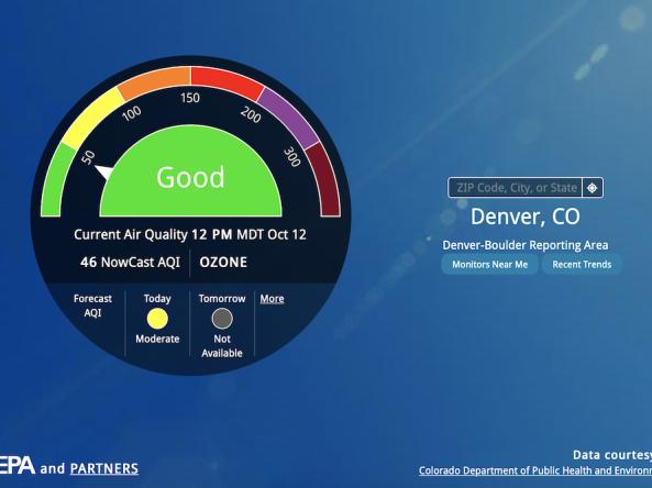
AirNow is a one-stop source for air quality data, including current and forecast air quality maps and data for more than 500 cities across the U.S., as well as Canada and Mexico.
The National Environmental Public Health Tracking Network brings together data on environments and hazards, health effects, and population health from national, state,
Related News

Site Section
News & Events
Drought represents a globally relevant natural disaster linked to adverse health. But while evidence has shown agricultural communities to be particularly susceptible to drought, there is a limited understanding of how drought may impact occupational stress in farmers.
To address this problem, NIDIS co-funded a study to examine the relationship between drought conditions and measures of job-

Site Section
News & Events
Over the last century, droughts have caused more deaths internationally than any other weather- or climate-related disaster. Droughts in the United States, however, are generally not thought of as public health threats. The National Drought and Public Health Summit, held June 17‒19, 2019 in Atlanta, brought together a diverse set of local, state, federal, tribal, non-profit, and academic
Site Section
News & Events
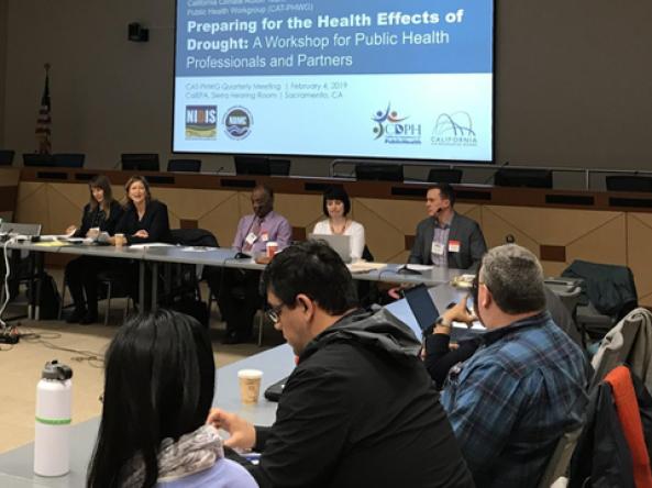
Droughts are not commonly thought of as public health threats. The often-slow onset of drought, compared to other extremes, makes it difficult to identify the links between the physical characteristics of drought and societal impacts. California is no stranger to drought, and the most recent drought brought to the forefront the impacts of drought on health, including decreased water quantity
Site Section
News & Events
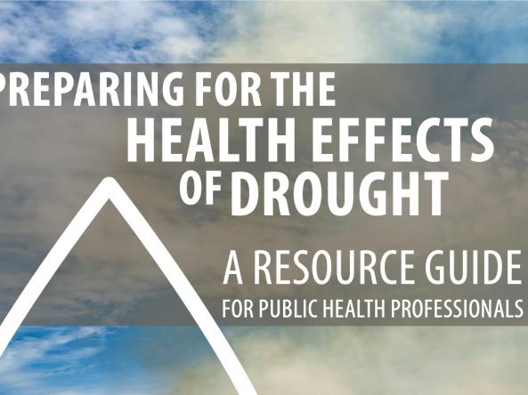
The Centers for Disease Control and Prevention (CDC) Releases ‘Preparing for the Health Effects of Drought: a Resource Guide for Public Health Officials’
Although the public health effects of drought can be severe, they are often hard to observe or measure directly, making them easy to overlook. Of the lengthy list of such effects, some of the most prominent are:
reduced access to
Related Documents
Document Preview
