Quarterly Climate Impacts and Outlook for the Chesapeake Bay Region for March – May 2020. Dated June 2020.
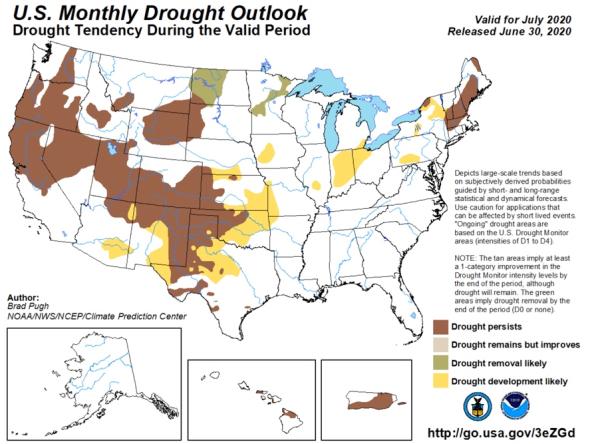
Temperatures varied widely across the spring months, with sites across the Chesapeake Bay watershed experiencing one of the warmest months of March on record, followed by one of the coldest months of April on record. The southeastern portion of the Mid-Atlantic region experienced drier conditions than normal, while the northwestern portion of the region experienced up to 150 percent of normal precipitation.

Quarterly Climate Impacts and Outlook for the Gulf of Maine Region for March – May 2020. Dated June 2020.
Spring temperatures (averaged over March, April, and May) were within 1°C (2°F) of normal for most areas, with parts of the Maritimes being colder and parts of New England being warmer. Spring precipitation (accumulated from March to May) ranged from 50% of normal to 110% of normal for much of the region.

Quarterly Climate Impacts and Outlook for the Northeast Region for March – May 2020. Dated June 2020.
The Northeast's spring average temperature was 0.4°F above normal, ranking in the warmest third of all years. The Northeast saw 98% of normal precipitation during spring, ranking in the middle third of all years.

Introduction to the Northeast Drought Early Warning System