U.S. flag

An official website of the United States government

Event Date
April 26, 2021

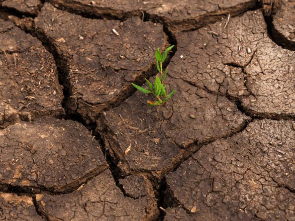
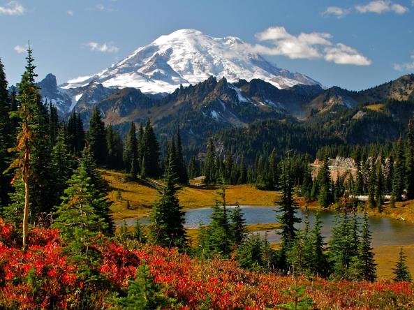
According to the April 20, 2021 U.S. Drought Monitor, 56.6% of the Pacific Northwest Drought Early Warning System (DEWS) is in Moderate Drought (D1). Additionally, a pocket of Exceptional Drought (D4) was added to Oregon, the first time that state has had D4 since 2015. Snow conditions this winter have been good in Washington and northern Oregon, and average to below average throughout the rest of the Pacific Northwest. What's the outlook for the rest of spring into summer?

Published on

When winter began, drought and dryness covered almost all of the Great Plains and West, and the snowfall in winter 2020-2021 didn’t do much to help conditions in the Western U.S. Explore drought conditions across the U.S. this winter in a series of 8 maps.

The NOAA National Weather Service River Forecast Centers each have an interactive website with a full set of real-time observations and forecasts, including snow and river conditions and water supply forecasts.

Event Date
February 19, 2021

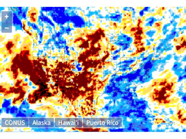
Nearly 50% of the Southwestern United States is currently experiencing the most severe drought classification (D4) conditions. The most recent U.S. Drought Monitor indicated that all of the Southwest was experiencing drought, and drought is expected to continue throughout the winter and into spring. This webinar will provide an update of current drought conditions and forecasts for Arizona, Colorado, New Mexico, Utah, and Nevada, followed by a demonstration of the new Drought.gov website.

Event Date
February 9, 2021

These webinars provide the region's stakeholders and interested parties with timely information on current and developing climate conditions, such as drought, floods, and tropical storms, as well as climatic events like El Niño and La Niña. Speakers may also discuss the impacts of these conditions on topics such as wildfires, agriculture production, disruption to water supply, and ecosystems. The February 9 webinar also featured a presentation on 2020 in review.

Event Date
February 16, 2021
12:00 pm - 1:00 pm
Location
Virtual

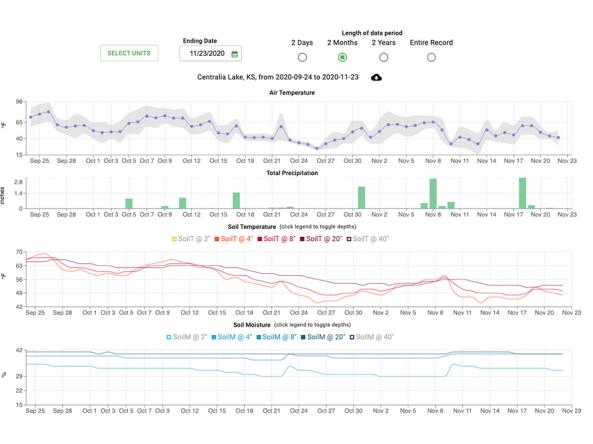
What does drought look like in Alaska? A series of webinars will be held to explore this topic. The first webinar will look at past climate information, focusing on unusually dry times, and will provide a statewide overview, including tools typically used to access drought/precipitation deficits with Rick Thoman, Alaska climate specialist.

Published on

This series of maps shows a recap of drought across the United States in 2020, covering U.S. Drought Monitor category changes, precipitation and temperature conditions, streamflow and groundwater levels, wildfire, evaporative demand, snow drought, and more.

The Global Gridded Standardized Precipitation Index (SPI) is derived from the CMORPH daily dataset and includes timescales of 1, 3, 6 and 9 months.  The NOAA CMORPH precipitation dataset is a gridded dataset derived from combining numerous microwave-based estimates from low orbiter satellites. 

This site provides decision tools and resources using data from weather stations in the SCAN and Tribal SCAN networks. The Soil Climate Analysis Network, also known as SCAN, supports natural resource assessments and conservation activities through its network of automated climate monitoring and data collection sites.

gridMET is a gridded dataset of daily high-spatial resolution (~4-km, 1/24th degree) surface meteorological data using PRISM and NLDAS-2, covering the contiguous U.S. from 1979-present.

Subscribe to Precipitation