Nebraska Mesonet Celebrates Ribbon Cutting for Final Upper Missouri Basin Station
On September 23, 2026, the Nebraska Mesonet celebrated a red-letter—or rather, red-ribbon—day, achieving a major milestone for national meteorologic and hydrologic monitoring. Users of mesonet data gathered from around the state for a ribbon cutting ceremony to mark the completion of its 35th and final station installed as part of the regional Upper Missouri River Basin (UMRB) Soil Moisture and Snowpack Project. This build out, which began in 2022, is led by the U.S. Army Corps of Engineers (USACE), working with state mesonets in Montana, Nebraska, North Dakota, South Dakota and Wyoming to install 540 new total water monitoring stations to support drought and flood preparedness.
For Nebraska, this partnership and funding arrived at a critical time. Five years ago, the number of active mesonet stations in the state was declining, and monitoring coverage of weather events in remote, rural areas was sparse. The UMRB project stations helped turn that trend around.
“These 35 stations have re-ignited interest in the mesonet in a major way,” said Nebraska Mesonet Manager Ruben Behnke during his speech at the ribbon cutting. He went on to express a hope that this partnered approach will provide a model for other parts of the country establishing or expanding their own monitoring networks in support of decision making.
National applicability of lessons learned in the UMRB is a key component of the UMRB Project as a whole, with NOAA’s National Integrated Drought Information System (NIDIS) leading a UMRB Data Value Study to understand potential value and applications of data from these new stations across sectors. Nebraska’s ribbon cutting provided real-world examples of how the purposes of these data envisioned regionally are already in action at a state scale.
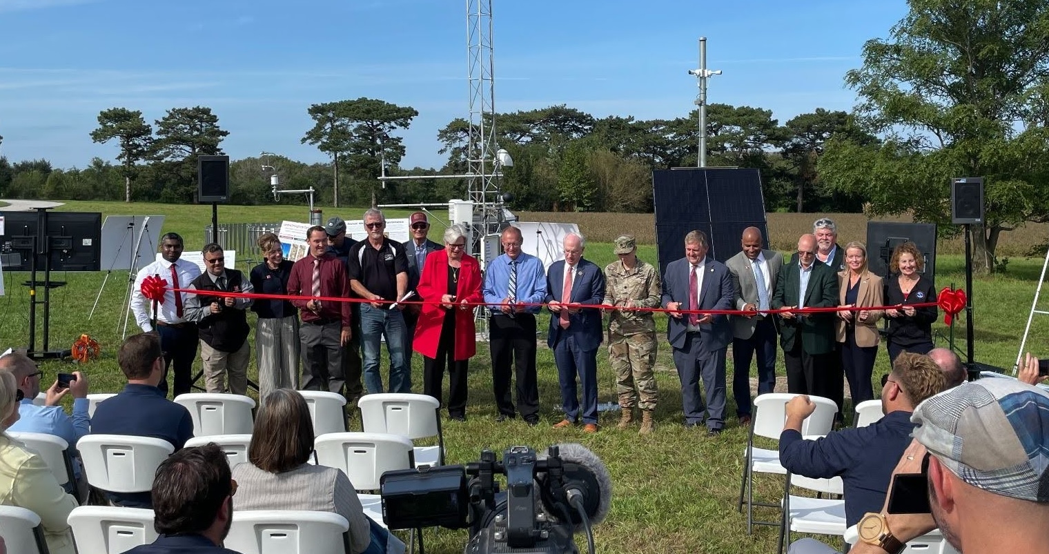
Mesonet data are used by multiple stakeholders, represented at the Nebraska event by speakers from the University of Nebraska Lincoln, USACE, National Weather Service Omaha, Nebraska Forest Service, Nebraska Emergency Management Agency, USDA Farm Service, the Upper Elkhorn Natural Resources District, Nebraska Medical Center, the U.S. Drought Monitor, the Nebraska Cattlemen’s Association, and the Nebraska Legislature.
Lieutenant Colonel Natalie Mallue of the USACE explained these new highly equipped stations that include soil sensors help the agency carry out its mission and directly address the need that led to the build-out: improved flood prediction and response.
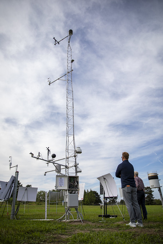
Steven Jara of the Nebraska Forest Service provided a parallel example of mesonet data informing preparedness and response for wildfire. During the Morrill Fire this summer, localized data from on-the-ground stations was used to position firefighting aircraft and envision potential wildfire behavior.
“Your work makes valuable information available to Nebraskan communities when they need it most,” he told the mesonet team.
Other speakers emphasized the importance of these data in routine, daily decision making. Ken Herz, former president of the Nebraska Cattlemen, provided examples of how data is used by producers to understand forage conditions or impacts their livelihood by informing insurance payments. Suzanne Fortin of National Weather Service Omaha equated a higher number of reliable data-providing stations to the ability to provide more precise and actionable warnings around weather events.
Common themes across multiple speakers included the importance of new stations in filling gaps in coverage of weather and water information, the benefits of public-private partnerships, and the importance of having localized data to compare with other information sources. For the Nebraska Mesonet, however, the mission is not yet over. The 35 new stations are all located within the northern portion of the state that sits within the Missouri River Basin. Ruben Behnke outlined a vision of a network distributed across the entire state.
“We hope that this network will continue to grow,” he said.