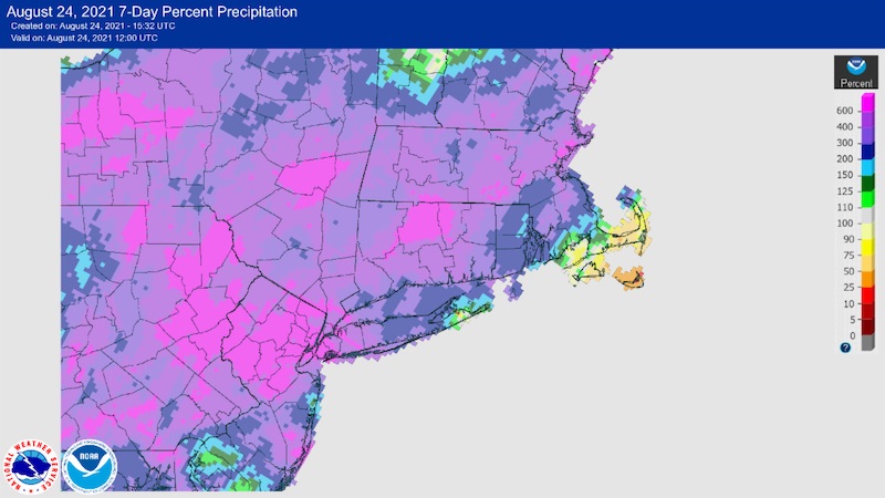
Rainfall from Fred and Henri missed most of Cape Cod and northern and western Maine, while providing ample tropical rainfall for much of New York and New England.
For more details, see the Northeast Drought Early Warning System Dashboard.
Key Points
- Severe drought (D2) persisted in western Maine and a small portion of neighboring northeast New Hampshire.
- Severe drought (D2) was introduced to southeast Cape Cod.
- Moderate drought (D1) and Abnormally Dry conditions (D0) persisted around these pockets of D2 and extended into northern Vermont and New Hampshire, and northeastern New York.
Current U.S. Drought Monitor map for the Northeast Drought Early Warning System with data valid for August 24, 2021. The U.S. Drought Monitor is updated each Thursday to show the location and intensity of drought across the country.
According to the latest U.S. Drought Monitor:
- Severe drought (D2) exists in 2.7% of the region.
- Moderate drought (D1) conditions exist in 13.3% of the region.
- Abnormally dry (D0) conditions exist in 14.5% of the region.
U.S. Drought Monitor Categories
Current U.S. Drought Monitor map for the Northeast Drought Early Warning System with data valid for August 24, 2021. The U.S. Drought Monitor is updated each Thursday to show the location and intensity of drought across the country.
According to the latest U.S. Drought Monitor:
- Severe drought (D2) exists in 2.7% of the region.
- Moderate drought (D1) conditions exist in 13.3% of the region.
- Abnormally dry (D0) conditions exist in 14.5% of the region.
Current Conditions
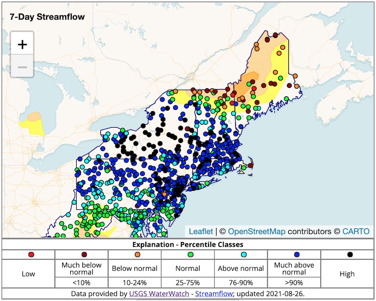
7-Day Average Streamflows
Streamflows are high or much above average across much of New York, Connecticut, Massachusetts, and Rhode Island and southern parts of New Hampshire and Vermont. Parts of northern New Hampshire and Vermont, and parts of Maine, are seeing below-normal or much-below-normal streamflows.
7-Day Percent Precipitation
This 7-day percent precipitation map highlights how Cape Cod has missed out on tropical moisture.
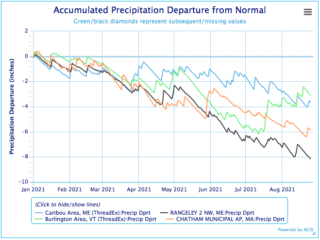
Annual Precipitation Departure from Normal
State-Reported Impacts
Maine
- Governor Mills Encourages Maine Businesses to Apply for Newly-Available Federal Drought Disaster Relief Loans.
- To date, 17 dry wells have been reported in Maine.
- Press Herald of Maine: Stressed by summer visitors, Stonington forced to buy water for its municipal supply
Outlooks
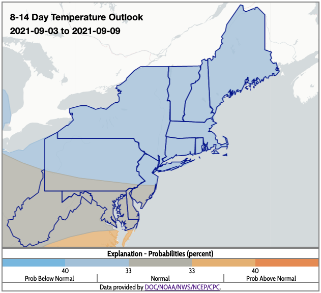
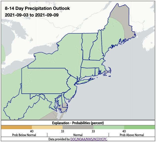
- The 8–14 day outlook indicates below-normal temperatures and above-normal precipitation for the region, except for northeastern Maine, where normal precipitation is favored.
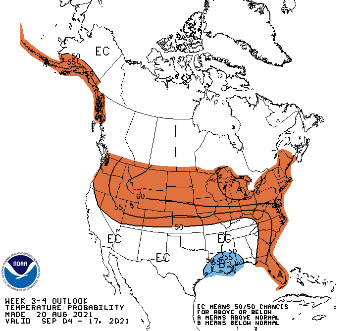
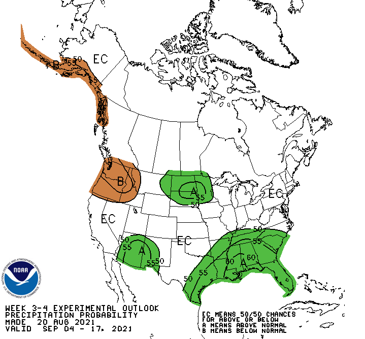
- The 3–4 week outlook favors above-normal temperatures across almost all of the Northeast and equal precipitation chances for the region.
Temperature Outlook 8–14 Day
Precipitation Outlook 8–14 Day
Temperature Outlook Week 3–4
Precipitation Outlook Week 3–4
Additional Resources
- Northeast DEWS Dashboard
- NOAA Regional Climate Services
- Your local National Weather Service office
- NOAA Regional Climate Services Monthly Webinar Series (next webinar is on August 31)
- USDA Northeast Climate Hub
- USGS New England and New York Water Science Centers
Contacts for More Information
Sylvia Reeves
Regional Drought Information Coordinator (Northeast DEWS)
NOAA/CIRES/National Integrated Drought Information System (NIDIS)
Email: sylvia.reeves@noaa.gov
Ellen L. Mecray
Regional Climate Services Director, Eastern Region
NOAA/NESDIS/National Centers for Environmental Information
Email: Ellen.L.Mecray@noaa.gov
Prepared By
Sylvia Reeves
NOAA/National Integrated Drought Information System (NIDIS)
Samantha Borisoff, Jessica Spaccio, Keith Eggleston, Art DeGaetano
Northeast Regional Climate Center
Ellen Mecray
Regional Climate Services Director, Eastern Region, NOAA
David Hollinger and Maria Janowiak
USDA Climate Hubs
Gardner Bent
USGS/New England Water Science Center
In partnership with National Weather Service Offices of the Northeast and State Climate Offices of the Northeast.
This drought early warning update is issued in partnership between the National Oceanic and Atmospheric Administration (NOAA), U.S. Geological Survey, and the U.S. Department of Agriculture (USDA) to communicate concern for drought expansion and intensification within the Northeast U.S. based on recent conditions and the forecasts and outlooks. NIDIS and its partners will issue future Drought Early Warning Updates as conditions evolve.
