U.S. flag

An official website of the United States government

Event Date
May 27, 2021
1:00 pm - 2:00 pm
Location
Virtual

North Dakota State University Extension specialists will host a live monthly webinar to assist ranchers as they navigate the drought. Each webinar will begin with an update on drought conditions and climate outlook. Specialists will then discuss upcoming drought triggers, how to assess triggers for ranches, and management strategies to consider. The goal is to help ranchers make timely decisions and enhance their ability to withstand the drought, as well as give them an opportunity to discuss drought-related concerns.

Event Date
April 29, 2021
1:00 pm - 2:00 pm
Location
Virtual

North Dakota State University Extension specialists will host a live monthly webinar to assist ranchers as they navigate the drought. Each webinar will begin with an update on drought conditions and climate outlook. Specialists will then discuss upcoming drought triggers, how to assess triggers for ranches, and management strategies to consider. The goal is to help ranchers make timely decisions and enhance their ability to withstand the drought, as well as give them an opportunity to discuss drought-related concerns.

Event Date
April 16, 2021
11:00 am - 11:30 am
Location
Virtual

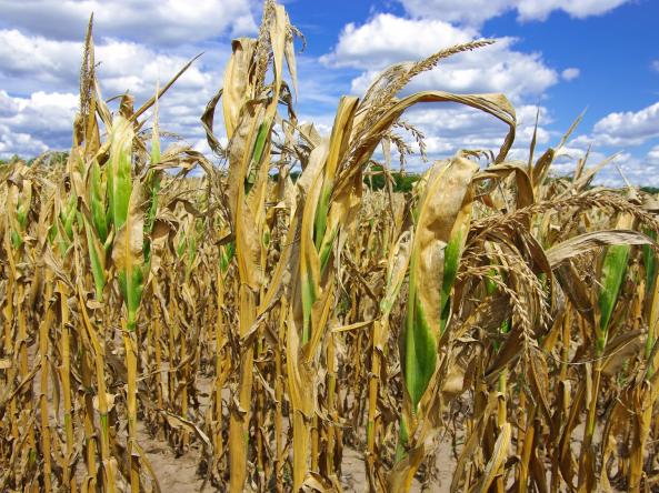
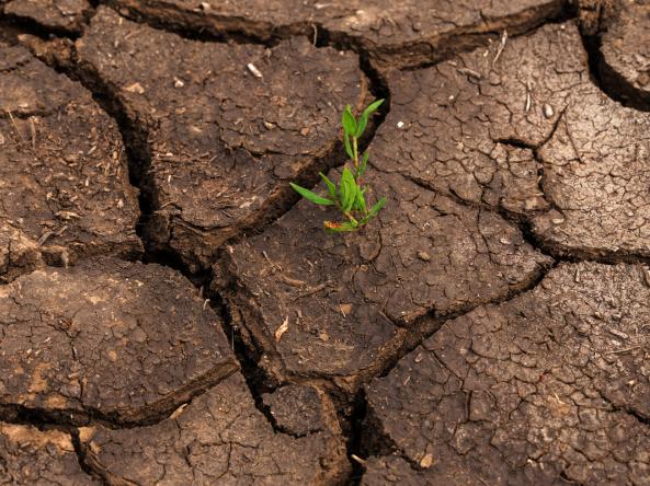
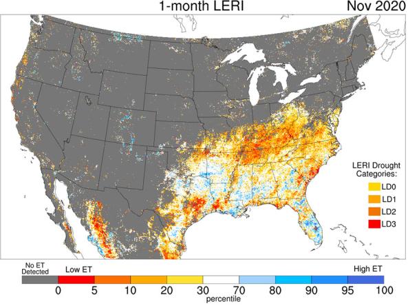
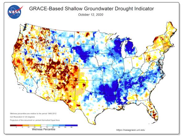
The most recent U.S. Drought Monitor indicated that all of the Southwest was experiencing some level of drought, and forecasts indicate these conditions are expected to continue through spring. In this short drought briefing, Arizona State Climatologist, Nancy Selover, will provide an update of current drought conditions and forecasts for Arizona, Colorado, New Mexico, Utah, and Nevada. Dannele Peck, from the Northern Plains Climate Hub, will then present the latest grassland productivity forecast for the southwest using the Grass-Cast tool.

Event Date
April 15, 2021
11:00 am - 12:00 pm
Location
Virtual

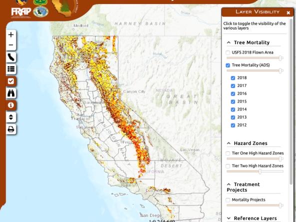
In this webinar, Southwest Climate Adaptation Science Center (CASC) researchers will describe recently published research where they estimate seed production and postfire regeneration of conifers in low-elevation California forests to help managers identify where management may be needed to encourage forest recovery after large wildfires. This webinar is part of a series of webinars hosted by the Southwest CASC, focusing on recent research from CASC researchers. 

Published on

Flash drought has serious real-world implications. The 2017 Northern Plains flash drought resulted in fires that burned 4.8 million acres and U.S. agricultural losses in excess of $2.6 billion dollars. Neither the drought’s swift onset nor its severity were forecasted. Episodes like this have sparked intense interest in flash drought in both the research community and the end user/applications community. Clear conceptualization of flash drought is important to both communities as there are differing understandings and confusion on what flash drought is and how it differs from other droughts. To address this need, NIDIS held a virtual workshop in December 2020 that convened researchers and end users to begin developing a shared understanding/definition of flash drought, and to identify research and tools needed to improve flash drought early warning.
 

Published on

This series of maps shows a recap of drought across the United States in 2020, covering U.S. Drought Monitor category changes, precipitation and temperature conditions, streamflow and groundwater levels, wildfire, evaporative demand, snow drought, and more.

The Landscape Evaporative Response Index (LERI) is an experimental drought monitoring and early warning guidance tool that measures the anomaly in the actual evapotranspiration (ETa) from the land surface. This web page provides LERI plots based on accumulated 8-day, monthly, seasonal, growing season, and annual ETa for the contiguous United States and northern Mexico at a 1-km spatial resolution. 

Interactive map shows results of 2012-2018 aerial tree-mortality surveys: numbers of dead trees per acre, high hazard zones, asset locations and more information related to drought-caused tree mortality and subsequent bark beetle infestations.

Groundwater and soil moisture drought indicators based on terrestrial water storage observations derived from GRACE satellite data and integrated with other observations, produced each week by NASA.

Global and Regional Vegetation Health (VH) is a NOAA/NESDIS system estimating vegetation health, moisture condition, thermal condition and their products.

Subscribe to Vegetation