
California-Nevada
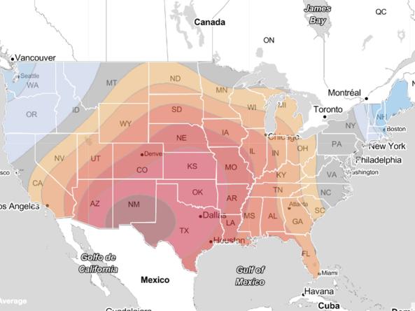
Drought in California and Nevada is a common occurrence that can last for multiple years. The regional climate is characterized by a distinct dry season (approximately May to September) and wet season (October to April) defined by a few large precipitation events. Additional peaks in precipitation can occur, such as summer precipitation in southern Nevada due to the North American monsoon. Topography within the region creates a diverse set of climate conditions, from the snowy peaks of the Sierra Nevada Range to the Mojave Desert, to the mountains and valleys of the Basin and Range. Given the extreme variability, both spatially and temporally, efficiently using and effectively managing finite water resources is a high priority. Based on the many connections the two states share with respect to geography, climate, water, and drought, a joint CA-NV drought early warning system (DEWS) was developed to support enhanced drought early warning across the region and to build out NIDIS’s national drought early warning system.
Primary contact: Amanda Sheffield, Regional Drought Information Coordinator

NOAA’s National Integrated Drought Information System (NIDIS) and Physical Sciences Laboratory are partnering with the California State Climatologist/California Department of Water Resources, NOAA’s National Weather Service and National Centers for Environmental Information, and the California-Nevada Adaptation Program (a NOAA CAP team) to deliver a user-oriented and evidence-based approach to drought early warning for sectors of our Nation’s economy susceptible to the hazards of too much and too little water. Since October, we have been releasing drought scenarios to a pilot group from Southern California water utilities, agriculture, or public health sectors that provide users with sector-specific, forward-looking outlooks of the most likely drought outcomes relevant to their decisions.
Regional Activities
The following table highlights activities in California and Nevada that are ongoing efforts related to drought, involve multiple partners, serve as a unique way to address regional drought needs, and are related to at least one of the components of drought early warning. Please contact Amanda Sheffield (amanda.sheffield@noaa.gov) for more information about the table or to inquire about getting an activity added to the list.
Drought Early Warning System (DEWS) Components Legend
This series of bi-monthly drought and climate outlook webinars is designed to provide stakeholders and other interested parties in California and Nevada with timely information on current drought…
Led by the National Oceanic and Atmospheric Administration (NOAA) National Weather Service, this coordination group converses bi-weekly to monthly to discuss the conditions in California-Nevada…
The Great Plains and California consist of the first and second largest economies in the U.S., but both regions are prone to extreme droughts. Yet, it is…
2020
2023
California and Nevada’s climate and weather patterns create fire-prone environments for many wildland–urban interface communities, highlighting the value in understanding the relationships between…
2017
2019
Forecast-Informed Reservoir Operations (FIRO) is a proposed management strategy that uses data from watershed monitoring and modern weather and water forecasting to help…
Observation + Monitoring
When monitoring drought, it is important to look at data across the spectrum—from the atmosphere, land surface, and water availability below the surface. The list of data and maps below has been customized for California and Nevada, and provides a snapshot of conditions across that spectrum, including streamflow, groundwater, snowpack, wildfire, and various derived indices for monitoring drought in the region.
Regional Data and Maps
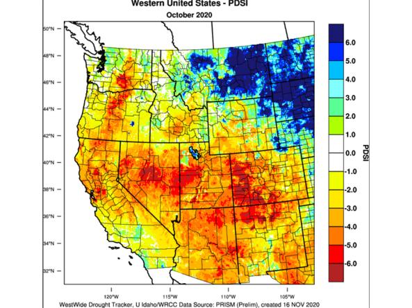
The WestWide Drought Tracker (WWDT) provides fine-scale drought monitoring and climate products for the Western United States.
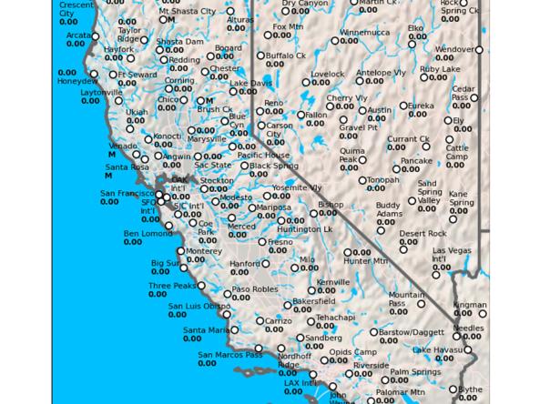
The California Data Exchange Center is a centralized database that stores, processes, and exchanges real-time hydrologic information on precipitation, river forecast, river stages/flow, snow, and r
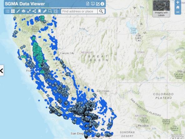
This interactive tool shows California groundwater level data, including depth below ground surface, groundwater elevation, and groundwater change in elevation.
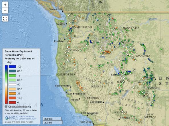
Point maps and interactive maps of snow water equivalent, snow depth, and snow density from the Natural Resources Conservation Service (NRCS) Snow Telemetry (SNOTEL).
The National Interagency Fire Center (NIFC) curates an ArcGIS Online organization to provide a common location for online mapping during wildland fire incident support and response activities.
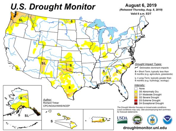
The U.S. Drought Monitor is a map updated each Thursday to show the location and intensity of drought across the country.
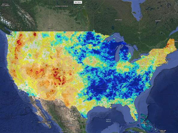
Climate Engine allows users to analyze and interact with climate and earth observations for decision support related to drought, water use, agricultural, wildfire, and ecology.
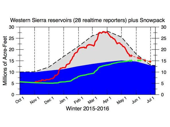
The CNAP Sierra Nevada Water Storage Tracker provides daily reservoir storage and snowpack information.
Planning + Preparedness
There is little that can be done to influence the weather patterns that cause drought, but preparatory actions and policies can help communities cope with drought impacts. Drought planning can ensure continuity of public services and quality of life. Drought planning can be done at the local and/or state level, or integrated into existing plans (e.g., hazard mitigation planning, land-use planning).
Regional Drought Planning Resources


Prediction + Forecasting
When will drought affect me? How long could it last? This section includes resources for drought prediction and forecasting on what could be ahead, including the short-term (e.g., 8–14 day forecast), seasonal to subseasonal (e.g., monthly), and future climate projections (e.g., mid-century). The appropriate time scale will depend upon how this information is being used (e.g., drought response, mitigation management action, long-term planning). Weather and climate prediction is an evolving science, as researchers continue to find ways to improve models and forecasting capabilities at various time scales.
Regional Forecasts and Outlooks
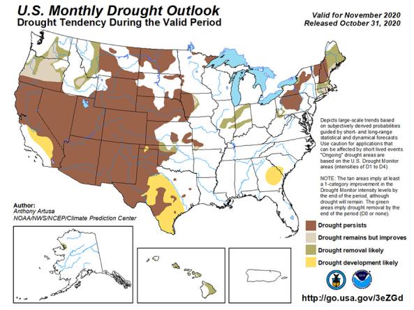
The U.S. Monthly Drought Outlook predicts whether drought will emerge, stay the same or get better over the next 30 days or so.
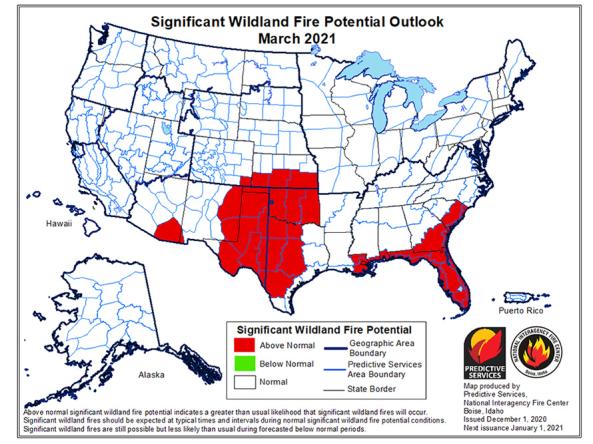
The National Significant Wildland Fire Potential Outlook is intended as a decision support tool for wildland fire managers, providing an assessment of current weather and fuels condition

The National Weather Service (NWS) Climate Prediction Center (CPC) produces monthly and seasonal drought outlooks based on Soil Moisture (CAS).
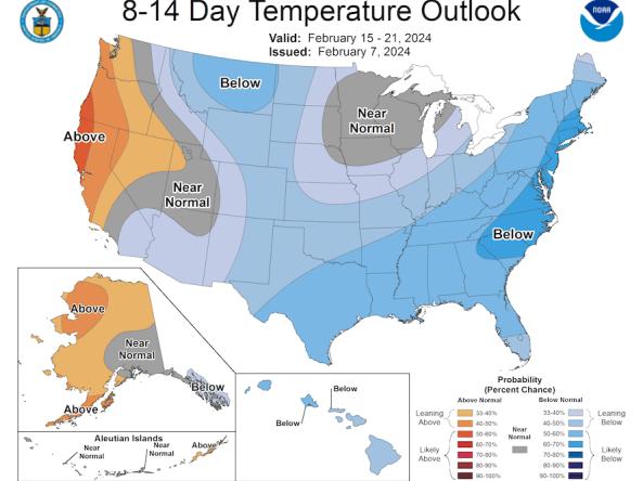
The Climate Prediction Center (CPC) produces temperature and precipitation outlooks for the U.S., including 6-10 day, 8-14 day, monthly, and seasonal outlooks.
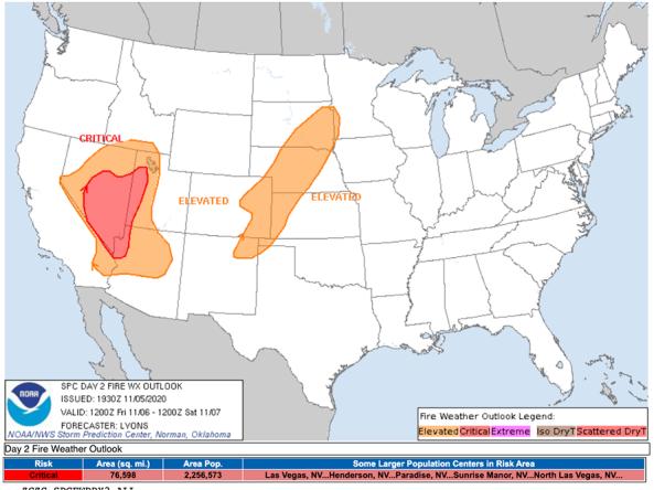
The National Weather Service's Fire Weather Outlooks are intended to delineate areas of the continental U.S.
UC San Diego Scripps Institute of Oceanography Center for Western Weather and Water Extremes (CW3E) provides observation and forecast datasets, including integrated water transport, integrated
Communication + Outreach
An important component for drought early warning is communicating this information to stakeholders across the California-Nevada region that need this information in order to make more informed decisions. There are various ways drought information is communicated across the California-Nevada DEWS, including a bi-monthly webinar series, regular drought status updates, a quarterly climate report, and the California-Nevada DEWS email list.
Regional Communications Documents


Research + Applications
Research to better understand drought in California and Nevada—and its development, persistence, improvement, and interaction with other hazards—is critical to providing timely and reliable information, products, and services in support of drought early warning. This page highlights research projects that are studying drought in the California-Nevada region, with support from NIDIS.